Good Design for Housing – NSW Gov digital map case study

Enhancing urban understanding through interactive mapping for NSW Government
Quick facts
- Client: Government Architect NSW (GANSW), NSW Department of Planning, Housing and Infrastructure (DPHI).
- Industry: Government / For purpose.
- Purpose: To improve understanding and visibility of low- and mid-rise housing in NSW through an interactive digital mapping solution.
- Solution: Good Design for Housing map
Project background
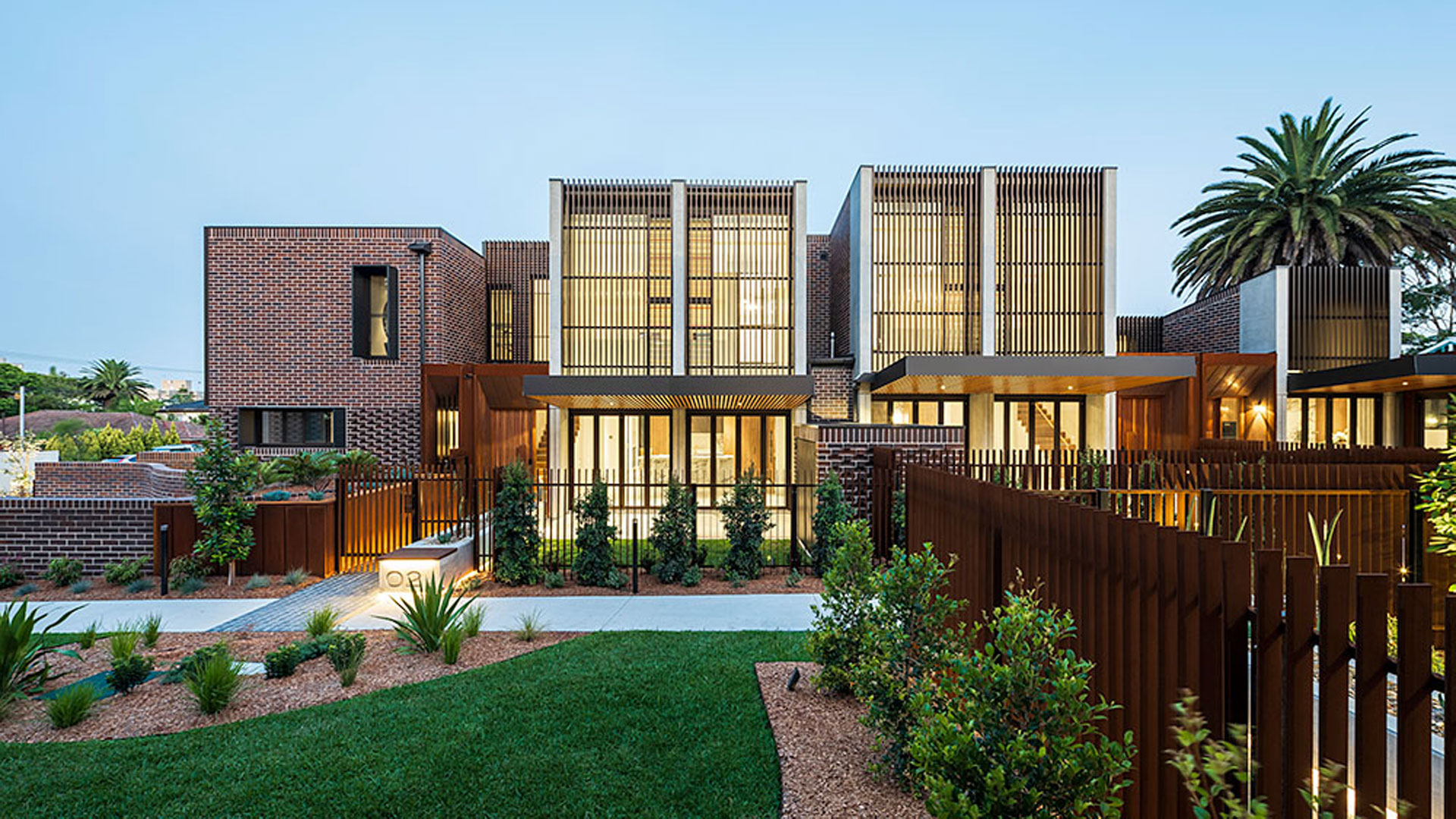
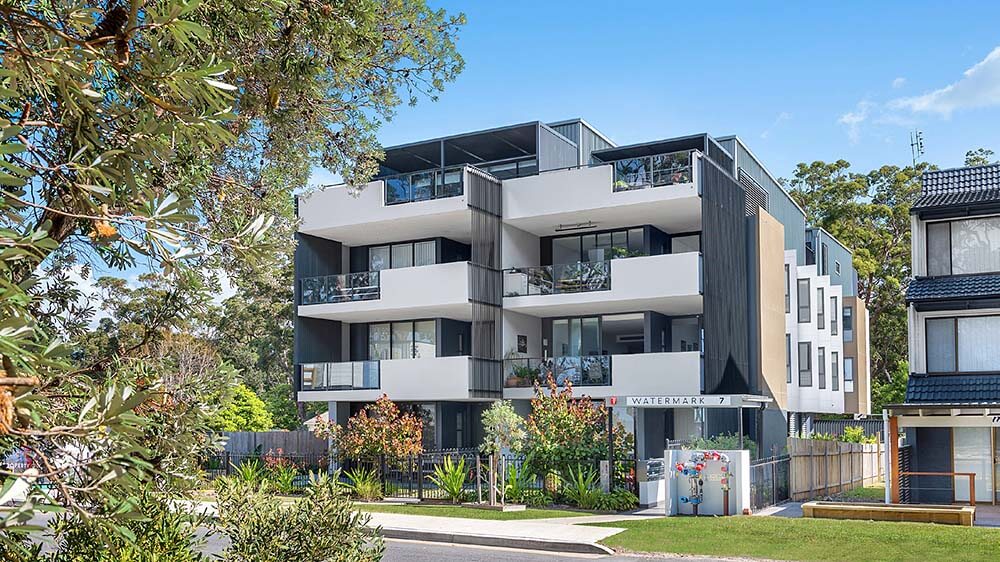
In NSW, where the architectural landscape boasts a vibrant mix of low density single detached dwellings and high-rise apartment buildings, low- and mid-rise housing have become underrepresented in new development planning. Recognising this gap, Government Architect NSW (GANSW), a part of NSW Department of Planning, Housing and Infrastructure (DPHI), aimed to elevate the profile of low- and mid-rise housing through the location of good examples that already exist in NSW. The objective was to encourage a more diverse urban environment and to inform future building practices through an engaging, informative digital solution.

Challenge
GANSW identified three key user groups—general citizens, architects, and town planners—who needed better resources to understand and explore low- and mid-rise housing options. The challenge was to create an interactive, evolving tool that could not only inform but also inspire stakeholders about the potential of low- and mid-rise housing developments. Furthermore, the project had to be complete within 6 months, to align with strategic objectives within the department.

Shane Dingwall
Digital Producer, Customer Technology & Engagement, NSW DPHISolution
Initial phase
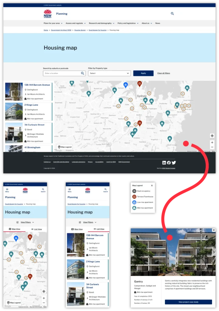
The project began with an overhaul of existing design assets to align them with the NSW Digital Design System (DDS). Starting with initial designs provided by GANSW, our Experience Design team applied the NSW DDS and created interactive prototypes in Figma. These designs underwent extensive user testing with participants from the three identified personas, resulting in iterative updates to enhance and streamline the user experience.
Development phase
Sitback developed a custom Drupal module that provides a progressively decoupled React component, leveraging the Google Maps Platform for mapping:
Custom map functionality: The interface featured customised map pins and a dynamic legend, enhancing interaction by dynamically displaying relevant building data based on user searches and selections.
Efficient data management: Native integration with Drupal’s content editing features ensures that DPHI can keep the map up-to-date effortlessly. Utilising the Drupal Feeds module, we enabled rapid upload of building details via CSV, accommodating both bulk and manual entry processes.
High performance and flexibility: By opting for a custom-built solution rather than a third-party SaaS product, we ensured enhanced performance by utilising Drupal’s caching system and hosting data locally, reducing dependency on external resources. This approach also eliminated the need for additional licenses or user seats, showcasing excellent cost efficiency and scalability.
Long-term ROI: The stand-alone Drupal module designed for this project is reusable across DPHI’s digital platforms, which drastically cuts down future project costs and maintenance.
Analytics and feedback: The integration of Google Analytics 4 allows for detailed tracking of user interactions and map engagement. This data is instrumental in guiding ongoing enhancements and proving the project’s success through tangible metrics.

Stephen Gouldsbury
Senior Drupal Developer, Sitback
Outcome
The interactive map was successfully launched in early May, accompanied by a robust PR campaign that garnered media coverage on both 9 News and 7 News, several radio stations, and national newspapers. The solution not only achieved high user engagement but also set a benchmark in digital innovation for government projects.

Shane Dingwall
Digital Producer, Customer Technology & Engagement, NSW DPHIImpact
This project has significantly raised the visibility of low- and mid-rise housing in NSW. It has become a crucial educational tool and planning resource, supporting DPHI’s goals of diversifying urban living solutions. The map encourages exploration and provides valuable insights into the benefits of low- and mid-rise developments, fostering a broader understanding among all user groups.
The Good Design for Housing Map Project stands as a testament to the power of bespoke digital solutions in governmental settings. It not only fulfils its intended purpose of educating and engaging the public but also offers scalability and efficiency, promising ongoing return on investment. As DPHI looks forward to incorporating advanced features like 360-degree views and AR/VR experiences, the future of this project is poised to set new standards in digital interactivity and user engagement.
Need a custom mapping solution?
If you’ve got information you need to communicate to your users through a digital map-style interface, and the out of the box SaaS tools just aren’t cutting it – either through lack of customisation options, or spiralling costs – get in touch to see if we can help. We’ll help you ‘locate’ the best ‘route’ to success 🤪